
USA 2016: Death Valley
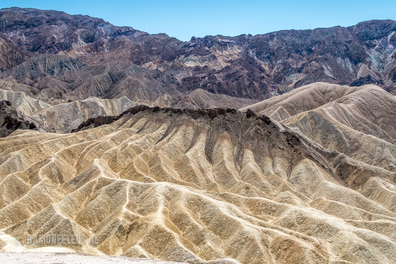
The western US is full of wild nature, which we'd already seen in Utah and at the Grand Canyon. But if you want to see even more extremes, you can't skip Death Valley. So, we drove west from Las Vegas, Nevada, towards California. Along the way, we were quite surprised by the traffic rules in the US. On the highway, we simply encountered cyclists—yes, cyclists! The highway is literally the only road in the area; there's absolutely nothing else. So, on a highway with a 70 mph (112.6 km/h) limit, you see signs telling cyclists to use the hard shoulder. Which was about half the width of the Netherlands; you could barely park your car there. So, we saw someone cycling again, and a truck just zoomed past. A few hundred meters further, there was a "hard shoulder ends" sign; the hard shoulder simply ended, so he was allowed to enter the roadway. And all this with temperatures that climbed steadily as we approached Death Valley, reaching around 40 degrees Celsius that day. It was truly wonderful riding a bike there! Just before Death Valley, there was a slight confusion about our route. We'd taken a wrong turn, which meant we ended up at the south entrance of the park instead of heading west as planned. Not a disaster per se, but the only downside was that while Dad was sorting things out, he decided to put on sunscreen outside the car. He must have lost his watch (which was four months old), what a shame. So if anyone wants to get it for us, it's probably near the turnoff to Badwater Basin, thanks in advance! The route through Death Valley took us through almost surreal landscapes. We saw sand dunes and rocks in all sorts of colors. Eventually, it felt like we were driving towards a stone wall; you couldn't see the sky from the car for a moment. We descended further and further towards the lowest point in the Western Hemisphere: Badwater Basin (-86 meters). Here, we walked around the salt flats. It's quite peculiar, though, in the middle of all those rocks, such an empty white plain. What was also striking is that you don't even see any birds flying in Death Valley. There's simply no prey, and the temperatures are too high. There was a sign that record temperatures of over 50 degrees Celsius had been recorded there. At those temperatures, crows even fell dead from the sky. It wasn't until the next day, when we were driving on the highway next to Death Valley, that we saw birds again. Their prey, mainly each other. At least, the road was covered in bloodstains; they seemed to live mainly on roadkill. From Badwater Basin, we took a detour to Artists Palette. The place is so named because you see all sorts of colors crisscrossing the rocks: pink, green, black, gray, yellow, etc., all mixed together on the same hills. Afterward, we stopped at Zabriskie Point, a well-known viewpoint surrounded by a strangely shaped volcanic landscape. Earlier in the trip, my father had found a Comboy hat along the road in Flagstaff, Arizona. Here in the full sun of Death Valley, he quickly experienced the benefits of a hat like that; it provides a bit more shade. I thought it was a funny picture, our cowboy :) We also made a quick stop in Rhyolite, a small ghost town. But with the rattlesnake warning signs, a long hike didn't seem so appealing.


